
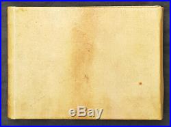
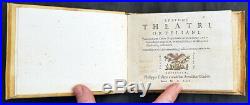
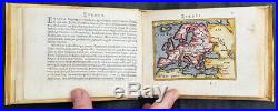
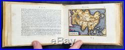
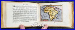


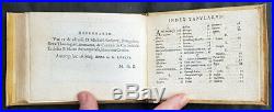
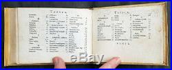

Philippo Gallaeo Arnoldus Cocinx MDXCV. Ortelius, Abraham 1528-98. (A+) Fine Condition. This stunning, original antique pocket Epitome Atlas, Theatrum Orbis Terrarum (Theatre of the Orb of the World) – with 106 beautifully hand coloured copper-plate engraved antique maps of the entire 16th century world, by Abraham Ortelius, was published in 1595 – dated on the title page, Latin edition – by Philip Galle. The atlas has been lovingly and professionally restored with fine vellum binding, end papers. Each page has been lovingly cleaned and faithfully re-coloured and tabbed back into the atlas as originally published. Along with the new end papers, the atlas contains the original dated title page, frontispiece, 6 text pages 109 maps, descriptive text and finally three index pages shown to the left. A unique opportunity to acquire one of the best, if not the best Epitome Atlas, on the market. Paper thickness and quality: – Heavy and stable Paper color : – off white Age of map color: – Original & later Colors used: – Yellow, green, blue, pink General color appearance: – Authentic Paper size: – 5 3/4in x 4in (145mm x 100mm) maps Plate size: – 5 3/4in x 4in (145mm x 100mm) maps Margins: – Min 1/4in (8mm). Margins: – Very light age toning on a few page margins Plate area: – Very light ink notations on title and Psalm pages Verso: – None. Background: The pocket versions, or Epitome, of Abraham Ortelius folio Atlas Theatrum Orbis Terrarum was published by Philip Galle with text by Pieter Heyns. Between 1577 & 1598 Galle issued 11 editions, of which 10 editions were printed by Christopher Platin , with this lone edition printed by Arnoldus Coninx in 1595, making it an extremely rare & unique item. The Dutch edition published by Heyn\’s son Zacharias in 1596, was a re-issue of of the 1583 edition. In addition to the Dutch, French, Latin & Italian editions an English one was produced. The first two editions, of Epitome, contained sixty-six miniatures and six small folding maps including one of the world dated 1574. They were all rather crudely drawn and engraved by Galle, with narrow decorated borders. From 1583 he gradually introduced a new set of maps, adding quality and quantity replacing the originals until they had grown to 123 by 1598. Theatrum Orbis Terrarum (Theatre of the Orb of the World) is considered to be the first true modern atlas. Written by Abraham Ortelius, strongly encouraged by Gillis Hooftman and originally printed on 20 May 1570 in Antwerp, it consisted of a collection of uniform map sheets and supporting text bound to form a book for which copper printing plates were specifically engraved. The Ortelius atlas is sometimes referred to as the summary of sixteenth-century cartography. The publication of the Theatrum Orbis Terrarum (1570) is often considered as the official beginning of the Golden Age of Netherlandish cartography (approximately 1570s1670s) (Ref: King; Van Den Broecke; Tooley). Ortelius, Abraham 1528-98 Abraham Ortel, better known as Ortelius, was born in Antwerp and after studying Greek, Latin and mathematics set up business there with his sister, as a book dealer and \\\’painter of maps\\\’. Traveling widely, especially to the great book fairs, his business prospered and he established contacts with the literati in many lands. On one such visit to England, possibly seeking temporary refuge from religious persecution, he met William Camden whom he is said to have encouraged in the production of the Britannia. A turning-point in his career was reached in 1564 with the publication of a World Map in eight sheets of which only one copy is known: other individual maps followed and then – at the suggestion of a friend – he gathered together a collection of maps from contacts among European cartographers and had them engraved in uniform size and issued in 1570 as the Theatrum Orbis Terrarum (Atlas of the Whole World). Although Lafreri and others in Italy had published collections of \\\’modern\\\’ maps in book form in earlier years, the Theatrum was the first uniformly sized, systematic collection of maps and hence can be called the first atlas, although that term itself was not used until twenty years later by Mercator. The Theatrum, with most of its maps elegantly engraved by Frans Hogenberg, was an instant success and appeared in numerous editions in different languages including addenda issued from time to time incorporating the latest contemporary knowledge and discoveries. The final edition appeared in 1612. Unlike many of his contemporaries Ortelius noted his sources of information and in the first edition acknowledgement was made to eighty-seven different cartographers. Apart from the modern maps in his major atlas, Ortelius himself compiled a series of historical maps known as the Parergon Theatri which appeared from 1579 onwards, sometimes as a separate publication and sometimes incorporated in the Theatrum Background of Theatrum Orbis Terrarum For the first time, in 1570, all the elements of the modern Atlas were brought to publication by Abraham Ortelius in his Atlas Theatrum Orbis Terrarum. This substantial undertaking assembled fifty-three of the best available maps of the world by the most renowned and up to date geographers. Unlike earlier compositions, such as the Italian composite or \\\”Lafreri\\\” Atlases, each of Ortelius\\\’ maps was engraved specifically for his Atlas according to uniform format. Through its launching, pre-eminence in map publishing was transferred from Italy to the Netherlands, leading to over a hundred years of Dutch supremacy in all facts of cartographical production. There were a total of 7300 copies of Theatrum published between 1570 – 1612 from 31 editions. Please note all items auctioned are genuine, we do not sell reproductions. A Certificate of Authenticity (COA) can be issued on request. What is an Antique Map. The word Antique in the traditional sense refers to an item that is more than a hundred years old. The majority of antique maps for sale today come from books or atlases and have survived due to the protection offered by the hardback covers. The first thing to determine when staring a collection or purchasing an item, is what is important to you. Most collectors prefer to build their collections around a theme. You may decide to collect maps from one region or country, charting its development through time. Similarly you could collect maps of one particular period in time, by type i. Sea or celestial charts or by cartographer. The collector might also want to consider the theme of cartographical misconceptions such as California as an island or Australia as Terra Australis or the Great Southern Land. The subject is so wide that any would-be-collector has almost endless possibilities to find his own little niche within the field, and thereby build a rewarding collection. Starting a collection & pricing. Pricing is based on a number of different factors, the most important of which is regional. In any series of maps the most valuable are usually the World Map and the America/North America. The World because it is usually the most decorative and America because it has the strongest regional market. Other factors that come into play re: price is rarity, age, size, historical importance, decorative value (colour) and overall condition and quality of paper it is printed on. As specialised dealers, we frequently work with first time map buyers who are just starting their collection. Classical Images was founded 1998 and has built an excellent reputation for supplying high quality original antiquarian maps, historical atlases, antique books and prints. We carry an extensive inventory of antiquarian collectibles from the 15th to 19th century. Our collection typically includes rare books and decorative antique maps and prints by renowned cartographers, authors and engravers. Specific items not listed may be sourced on request. Classical Images adheres to the Codes of Ethics outlined by the Antiquarian Booksellers Association of America (ABAA). We are a primarily an online based enterprise, however our inventory may be viewed by appointment. Track Page Views With. Auctiva’s FREE Counter. The item “1595 Abraham Ortelius Antique Epitome Atlas with 106 Maps Rare Unique, Beautiful” is in sale since Monday, June 8, 2020. This item is in the category “Antiques\Maps, Atlases & Globes\World Maps”. The seller is “searching01″ and is located in Melbourne, Vic. This item can be shipped worldwide.
